As adverse as the national level conditions have been generally for anyone concerned about the direction of this country and its respect for fundamental human rights as well as the causes we hold dear in particular, we here at WalkUP Roslindale can still look back at this year at the local level as one of significant accomplishment and enduring improvement for our pro-housing and pro-walk, -bike, -transit advocacy. It is always difficult to choose what seems most significant in a given period of time, but it seems to us that three things stand out most prominently for 2025:
First, the Boston Zoning Commission’s adoption in February of the Squares + Streets zoning text and map amendments for Roslindale Square and its key radiating corridors. This was a very big deal on several levels, but perhaps none more so than the elimination of off-street parking minimums coupled with increases in as-of-right housing density within the rezoned area. The following selected posts from this website give a sense of the process as we experienced it starting in 2024 and running into 2025 as well as the first proposed project within the heart of the square that makes full use of the flexibility allowed by the new zoning – a decidedly admirable and eminently supportable all-affordable, mixed-use, senior-focused development that requires no zoning relief whatsoever:
Squares + Streets – Small Area Planning Process – Roslindale Square Kickoff Open House
Three thoughts on Squares + Streets as we get underway in Roslindale Square
Guest Post – Nate Stell from AHMA: Rezone the residential streets too!
First in an occasional series – Elvira Mora of WUR and AHMA
Open Letter in Support of Squares + Streets
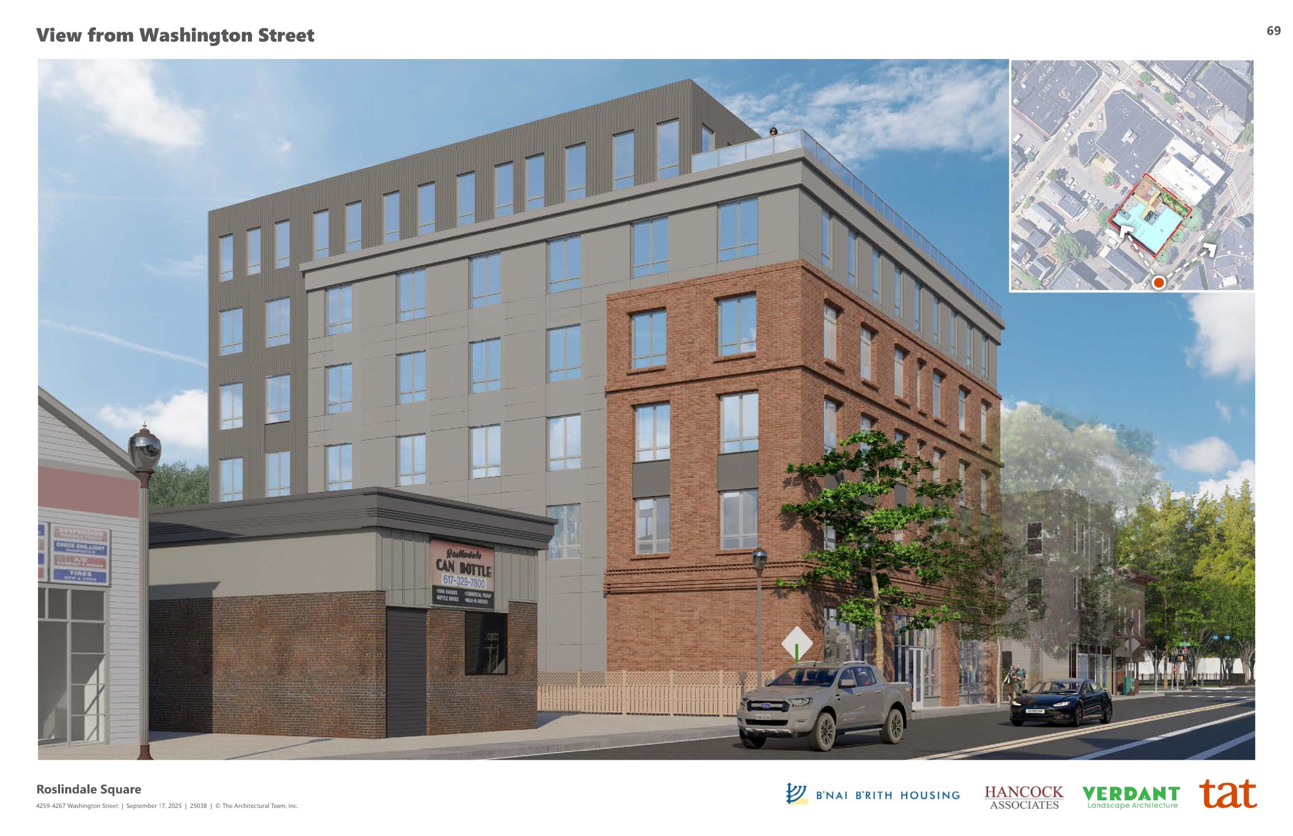
First Fruits for Squares + Streets…4259-4267 Washington Street come on down!
Second, the 3-part walk audit series sponsored by a micro-grant from the American Association of Retired Persons that looked at the Washington Street corridor between the square and Archdale Road, Roslindale Square’s key intersections, and Cummins Highway’s mid-section around the new Sarah Roberts School. We very much appreciated AARP’s support and were truly stunned at the speed with which the Washington Street audit’s focus on a half-dozen badly heaved sidewalks near street trees resulted in virtually immediate fixes, resulting in vastly improved walkability and rollability in this key neighborhood corridor. Post links:
From Audit to Action: Washington St. Sidewalks Repaired!
Third, and finally, we were tremendously gratified to see Phase 1 of the Roslindale Gateway Path open between the end of the Blackwell Path at South Street and Arboretum Road. Roslindale Gateway Path is and has been a foundational, long-term advocacy project for us, so this first phase is welcome and we are eager both to solidify the major improvement in Arnold Arboretum access it represents and to push even harder to get the rest of the path implemented so we can truly open this amazing public resource to much more of Roslindale. Post link: Soft Open Alert – Roslindale Gateway Path Phase 1!
And so, that’s what we think of when we think of this past year’s efforts. And now it’s on to 2026…